Skip to content

The Expedition…


The USCGC Healy

In response to the imminent threat of climate change on the ocean, this expedition, the first National Science Foundation funded of its kind, will head to the Western Arctic Ocean to study ocean acidification. Human activities such as the burning of fossil fuels and changes in land use practices have led to an increase in atmospheric carbon dioxide and uptake of carbon by the ocean. These increased carbon dioxide concentrations lead to a decrease in the average pH of the surface waters of the ocean, a process called ocean acidification. The purpose of this expedition is to directly address questions of how human-induced climate change is affecting ocean chemistry in the Western Arctic Ocean.


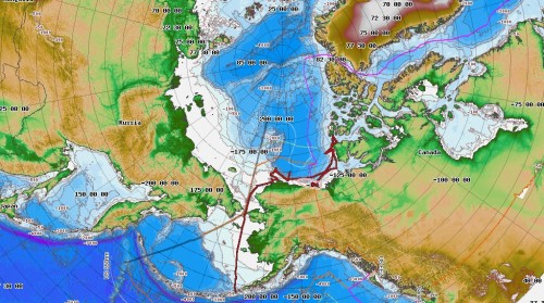
Cruise Track (Red line) Courtesy of Healy Map Server


The cold waters of the high latitudes are particularly vulnerable to ocean acidification due to increased solubility of carbon dioxide at low temperatures and low carbonate ion concentrations due to mixing patterns. This increased uptake in carbon dioxide along with the loss of sea ice and high rates of primary productivity over the continental shelves lead to increased ocean acidification in the Arctic Ocean and marginal seas. The rapid rates of change facing the high latitudes may have profound impacts on many organisms, particularly calcifying organisms that form calcium carbonate shells and hence need calcium carbonate minerals such as aragonite and calcite. Because of the sensitivity of these high latitude ecosystems to ocean acidification and their accelerated rates of change compared to lower latitudes, they become a real-time laboratory for understanding the changes and impacts of climate change on organisms and their possible cascading effects on the foodweb.

This study will be the first comprehensive assessment of the impacts of physical and biogeochemical processes on carbonate mineral saturation states and ocean acidification in the western Arctic Ocean and provide fundamental data for the understanding of ocean carbon cycle dynamics in the Pacific sector of the Arctic Ocean.


October 1: Flying to Dutch Harbor


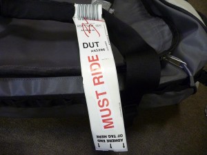
Flying to Dutch Harbor is always an adventure.  I have only flown out of Dutch once before so I kind of knew what I was getting into.  A few things to worry about when flying into Dutch, the number one being getting your baggage and the next the sketchy landing with a cliff on one side and water on the other; apparently a vast improvement from what it was before.  To address the first issue, when I got to the airport in Anchorage, I begged and pleaded with the woman at the counter to make sure my bags got on the plane.  My two duffels were filled with everything I could need to work and live for the next 4 weeks aboard the Healy and without them, it was going to be a long month.  I also knew that I was on the last flight in for the day, so this was my shot to get my gear before setting sail.  Finally when I told them I was getting onto a ship, they put big “Must Ride” stickers on my bags…so I wasn’t crazy for worrying as they were well aware of the problem of bumped baggage.  I was already carrying about 40 lbs of gear on me between my pelican case with cameras, hard drives and a backpack with cameras, my computer, etc…Being at sea is unlike anything else because if you don’t have something with you, well you won’t have it until you get back home.  It makes keeping the weight of your gear down difficult.

After negotiating the ticket counter and my bags, telling them my weight and having my carry-ons weighed, it was time to anxiously wait for the flight with nervous anticipation of my bags making the flight.  I was not buying the “Must Ride” sticker.   The plane to Dutch is a small prop plane and they cram the seats in…the plane is old and rickety and uncomfortable, but I am on my way to Dutch.  The captain comes on and informs us that all of the bags are on the plane, that’s a relief, but because we took all of the bags, we have to make some fuel stops, first in King Salmon and then in Cold Bay.  Knowing that my bags are on the plane is a relief as now I know I have all of my gear, and I am always into seeing new places…although the idea of not taking enough fuel is not the best feeling in the world.

So with a brief fuel stop in King Salmon, the pilots decide we don’t need to stop in Cold Bay and we land safely in Dutch.  The view from the plane is beautiful.  Dutch Harbor is beautiful, a large harbor surrounded by green mountains.  We got very lucky with the weather as it was a beautiful day whereas the day before, the wind was howling and it was miserable.  Sure enough my bags made it on the plane as did everyone else’s including all of the science party’s bags from the earlier flight.  Step Two down, all of my gear and I made it to Dutch!

Dutch Harbor


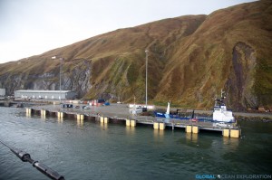
After dropping off all of my gear on the Healy, it was time to explore Dutch Harbor and pick up a few last minute items before setting off.  Here are a few pictures from the rainy excursion.


The view of Dutch Harbor from the old Russian Orthodox Church

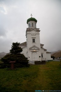
The iconic Russian Orthodox Church

October 2: Into the Bering Sea…


At 1600, it was time to cast off the lines and head out into the Bering Sea, and apparently some rough weather.  In the safety of Dutch Harbor, the weather seemed fine although a bit rainy, but beyond this safety, the Bering Sea was living up to her reputation.  There is always a strange feeling when the ship leaves the dock and you know that there is no turning back.  It is hard to describe, something between nervous and excitement, anticipation of the unknown…perhaps that is what is best about going to sea.

Leaving Port

Heading out to sea

So with that, we were off, leaving port to begin our journey north to the Bering Strait and into the Arctic Ocean.  It will be around a three-day steam to our first stop where we will pick up a mooring before heading through the Bering Strait.  Hopefully the weather will not be terrible.  We are trying to skirt in between two low pressure systems that would bring some rough weather.  But right out of Dutch, the Healy started rocking and rolling and we started feeling the fury of the Bering Sea with 40 knot winds and some big swells.  Hopefully it will calm down a bit…

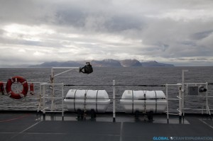
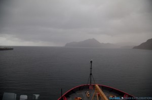
The Bering Sea with Dutch Harbor in the distance

October 3: Transiting


The seas calmed down a bit or rather the wind subsided and we are in huge glassy swells, all in all a nice day on the Bering Sea.  We are transiting so not much is happening.  I spent a good deal of time on the bridge watching passing birds and whales.   Transit days are good days to catch up on work and to get organized because once the sampling starts, it gets very busy very quickly.  The day ended with a beautiful sunset and the continued big swells.

October 4: The Bering Strait


Today was another beautiful day on the Bering Sea with the sun shining and relatively calm seas.   It is another transit day so we are moving quickly northward to our first sampling stations which we should reach by Wednesday afternoon. With St. Lawrence Island behind us in the early morning, we continued to cruise observing birds and seeing lots of whales and a walrus!  Very cool.


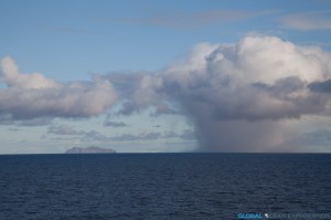
King Island in the distance next to a snow squall!

The Diomedes

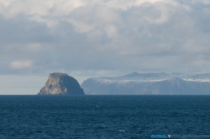
In the late afternoon, in the distance loomed the Diomede Islands, marking the middle of the Bering Strait.  Ever since I can remember, I had wanted to see the Bering Strait and here it was right in front of me with Russia to the west and Alaska to the east.  We had perfect weather to see far into the distance with a few snow squalls dotting the horizon.  As we came upon the Diomedes, it became hard to imagine how people can live in this super harsh remote environment, but there are small communities living on both islands.  With Fairway Rock glinting in the sunlight, we passed the Diomedes and through the Bering Strait with the occasional bird and whale cruising by.  It was a beautiful afternoon and hard to imagine that I am actually here.


Fairway Rock in the sunshine with Little Diomede behind

Shortly after, we crossed the Arctic Circle and officially entered the Arctic and are that much closer to our study site.  The day ended with a beautiful sunset over Russia and a sky filled with stars and an orange half moon.  It is getting colder and colder as we head north.   I am very excited to get the science started tomorrow!


The sun setting over Russia as we pass through the Bering Strait

October 5: Test Station & a Buoy


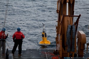
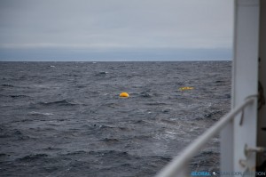
In the Chukchi Sea now, we reached our first stopping point of the cruise where we picked up a buoy that had been deployed over the summer.  The buoy had to be recovered before the winter.  It always amazes me when seemingly out of nowhere we come upon a high-tech instrument just anchored to the seafloor collecting important data.  Along with the water sampling being conducted on this cruise, moorings and buoys will be recovered and turned around.


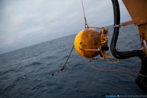
The Buoy coming on board the fantail

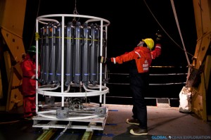
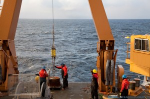
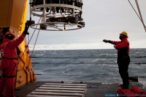
Also at this point, we did a test CTD (conductivity, temperature, depth recorder) cast to make sure that all of the instruments were working and the bottles to collect water fired properly.  The CTD and accompanying water-collecting rosette are the heart and soul of this expedition so this test cast was very important to make sure everything was in order.  We are arriving at our first sampling line this evening and will sample throughout the night along a given transect line that was sampled last year.  I will be writing a lot more about this in upcoming posts!

Deploying the CTD

So after a long transit, we are getting the science started! Very exciting!!!


October 6: First Sampling


Slate-Colored Junco (Photo credit: Luke DeCicco, USFWS)

In the wee hours of the morning, we began the CTD casts along our first transect and continued to sample throughout the night until the late morning when it was time to retrieve a mooring.  The mooring had been deployed last year in order to record salinity, temperature and a variety of other physical parameters of the water.  The scientists are excited to retrieve their instruments and find out what has happened in the year since its deployment.

It is kind of a cloudy and cold day with snow dusting the decks but we still are experiencing calm seas.  There have been quite a few birds surrounding the ship including a songbird, a slate-colored junco, a subspecies of the dark-eyed junco, that must have lost its way from its home in the arboreal forest.  One of my favorite things about being at sea is discovering these little creatures seeking refuge on the ship after they have lost their way.  This little guy hung out on the boat for a while before hopefully heading south out of the Arctic.  They are not often spotted this far north so he had certainly lost his way.


October 7: Distributed Biological Observatory


Shortly after midnight, with the lights of Barrow glowing in the distance, we arrived at our next sampling line, the DBO line.

Deploying the CTD rosette with the lights of Barrow glowing in the distance

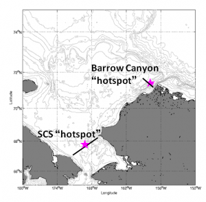
The DBO or Distributed Biological Observatory is an Arctic biological time series designed by Dr. Jackie Grebmeier from the University of Maryland to look at core oceanographic parameters such as temperature and nutrients in regional hotspots in the Arctic throughout the year.  This line consists of eight stations in the waters just offshore of Barrow crossing Barrow Canyon.  This time series is based on the cooperation of various research ships from the USA, Canada, Russia, China and Japan, committing to sample this line when they are operating in the Chukchi Sea.  I wanted to make sure to highlight the DBO in the blog because of the magnitude of importance of this kind of multi-national cooperation amongst scientists.  This collaboration and cooperation allows the collection of a tremendous data set that creates an annual and seasonal time series that will be able to quantify the changes to this important Arctic Ocean ecosystem in the face of climate change.


Map of DBO lines (from http://pag.arcticportal.org)

October 8 & 9: 24 hour operations


Recovering a mooring recording the sounds of the Arctic

We are in the middle of the first phase of the cruise which consists of recovering and deploying moorings in the Chukchi and Beaufort Seas.  Most of these moorings have been on the bottom of the ocean collecting data since being deployed on last year’s cruises.  It is amazing to think about the time series of data that these instruments are collecting.  There are a variety of moorings being deployed and recovered, collecting all kinds of data, from physical oceanography data, to chlorophyll measurements to acoustic data listening for passing mammals.  So much can be learned from these instruments because they are in situ for so long monitoring the changes throughout the year.

Mooring operations must be completed in daylight so we have been doing CTD casts all night and the mooring ops and any necessary transiting during the day.  Ship time is valuable so all minutes and hours of the day must be used efficiently.  We have a few more days of mooring ops to complete before moving on to the second phase of the cruise which will consist of 24 hour a day CTD casts and water sampling!


Profile: Jessica Cross

The key to getting research accomplished both in the field and in the lab is a good team.  Dr. Jeremy Mathis has put together a stellar group of young scientists in his Ocean Acidification Research Center (OARC) at University of Alaska-Fairbanks.  I am having the pleasure of working with and learning from two of his current students while on board, Jessica Cross, a PhD student, and Stacy Reisdorph, a Masters student.  Jessica and I sat down for a little chemistry lesson last night before she went on watch and I learned all about her research and her path to studying ocean chemistry…


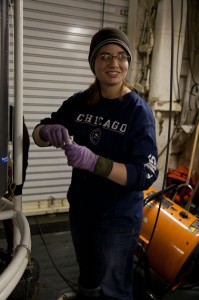
Jessica takes a water sample after a deep cast.

The USCGC Healy has become like a second home to Jessica as she has spent, in the past two years, more than 200 days aboard sailing mostly in the Bering Sea in order to collect data for her PhD research.  A few years ago, when Jessica was a freshman at Rhodes College in Tennessee, she would never have imagined herself studying chemistry, let alone oceanography, as her first passions were books and writing.  Now entering her fourth year of her PhD, she can’t imagine doing anything else and shows giddy excitement for ocean chemistry and endless enthusiasm for her work.  Spending all of those days at sea after her initial coursework gave her a thorough understanding of basic oceanographic concepts and she explains how there is no better way to learn than to be at sea with other scientists who are willing to share their knowledge and experience.  In the short time I have been at sea with Jessica, it is clear that she knows how to get work done efficiently and enjoys collecting samples for not just her own research but for the lab as a whole.

Jessica’s work focuses on ocean acidification in the Bering Sea as part of the Bering Ecosystem Study project (BEST).  (Note: GOE participated in a BEST cruise in April/May 2008 in the Bering Sea…see Bering Sea Ice Expedition for more details)  Jessica has been collecting and analyzing water samples from the Bering Sea for Dissolved Organic Carbon (DIC) and Alkalinity in order to determine the pH (measurement of acidity) of the water.  Armed with this knowledge, she then can figure out the carbonate saturation state that is vital to the shell-building animals of the ocean, and in the Bering Sea in particular, the King Crab. The Bering Sea is a particularly interesting system, as is the Arctic Ocean, because of the variety of water mixing from river outflows, deepwater upwelling, surface water and ice melt creating an acidic environment in its natural state of equilibrium due to these various natural inflows of carbon dioxide.  The question for the present and the future, is whether the increased anthropogenic carbon dioxide, and in turn the decreased pH in the Bering Sea, will affect the animals’ ability to adapt to their changing environment?  Jessica seeks to quantify these changes and her excitement for the work is contagious.

October 11: BS3 Mooring


The BS3 Mooring coming down the Port side of the ship after being released from its anchor.

.

After continuing our sampling through the night, it was time to recover the BS3 mooring in the waters northeast of Barrow.  This mooring was deployed on last year’s cruise and has been taking measurements of the water column for the past year creating an incredible data set that is key to understanding the Arctic shelf ecosystem.  The instruments on the mooring have been collecting various measurements including temperature, salinity, nitrate, pCO2, and pH.

Everyone is anxious to get back to the lab to look at the data collected from these instruments and create a picture of what the water column looked like for the past year, from the open water of the fall through the ice-covered winter through the spring and summer melt until now.  The changing ocean conditions affect the measurements tremendously as do currents and upwellings that occur seasonally in this area.  By understanding these variables, the scientists can better understand what will happen when there is less ice in the future due to the warming climate.


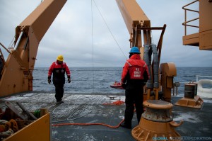
Preparing the snowy deck for the recovery of the mooring

The small boat hooks a line from the boat onto the buoy

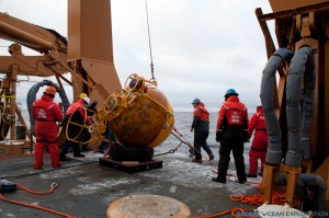
The first part of the mooring coming on board. The pCO2 sensor in on the chain behind

Successful recovery of the mooring!

Dr. Jeremy Mathis with his pCO2 sensor from the mooring…excited to see the data!

The mooring will be re-deployed in the coming days to collect data for the next year.


October 12: Mooring Deployment…Phase II


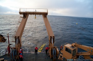
The new mooring buoy ready to be deployed

After recovering two moorings yesterday, the team did a quick turnaround due to impending weather and redeployed them today.  Like recovering the mooring, deploying was quite an operation done with careful precision.  The BS3 mooring with all of its various instruments was redeployed to collect data for another year adding to the time series of data from this location.

Fresh new instruments being deployed. An ADCP and pCO2 Sensor

The Mooring Anchor

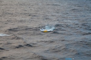
Right before heading into the depths…

See you in a year…

With the mooring operations complete, we are moving on to Phase II of the expedition which involves a long steam northeast to the Canadian Archipelago where we will be completing CTDs and water sampling along the shelf.  I am very exciting for this work as we will be heading into the ice!


What is Ocean Acidification?


The purpose of this cruise is to learn about the ocean chemistry of the Arctic Ocean and in particular ocean acidification.  So the question is, what is ocean acidification (OA) and why do we care?  The short answer is that OA is the decrease in pH of the ocean due to increased free hydrogen ions in the water making it more acidic.  We care because with this increasing acidity, the amount of carbonate minerals, in particular calcite and aragonite, available for animals to use for shell production and other metabolic needs, decreases and the ocean becomes under-saturated with respect to these carbonate ions.

Here is a diagram of the chemical reaction that leads to ocean acidification with the introduction of carbon dioxide, CO2, into the ocean.  In the past century, since the Industrial Revolution, more and more CO2 is introduced from anthropogenic sources.  The carbon dioxide enters the ocean, a sink for the CO2, where it combines with water and becomes carbonic acid which is very unstable.  The carbonic acid breaks apart leaving a free hydrogen atom and bicarbonate.  The resulting bicarbonate breaks up farther becoming a carbonate ion and another free hydrogen ion.  Acidity is dependent on the number of hydrogen atoms in the water column so with more hydrogen atoms, you get a lower pH or higher acidity.  On this cruise, dissolved inorganic carbon (DIC) and alkalinity are measured in order to derive pH.  Alkalinity is the measure of the buffering capacity of water or the capacity of the water to neutralize acids.  This buffering capacity is largely in the form of bicarbonate.

This graph shows the increase in CO2 concentration in the atmosphere since the 1950s and is the longest time series of data for this measurement.  The ocean is a sink for much of this CO2 and has taken up between 1/3 and ½ of all anthropogenic CO2 emissions.  Because the amount of CO2 in the ocean’s surface waters has increased considerably, the acidity of the ocean has increased due to the reaction outlined above.  This increased acidity is highlighted in the Arctic regions where the ocean is naturally low in carbonate ion concentration due to ocean mixing patterns and increased solubility of CO2 in cold water.


The water samples collected on this cruise will help to build a better, more accurate, picture of how the increasing CO2 in our atmosphere will impact these fragile ecosystems.


October 13: Transiting


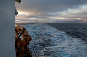
The ship’s wake as we head east…

After finishing up the first phase of the cruise yesterday, we began to steam east late last night.  We are about midway through our 36-hour steam to the Canadian Archipelago where we will be sampling in the ice and along the ice edge.  Heading so far to the north and east means we will be “off the edge” of our internet service for a few days so stay tuned after the weekend for updates!  Hopefully there will be lots to report from our time in the ice…


October 14: Rough Seas and Sampling in the East…


After 36 hours of steaming, the day dawned with a beautiful sunrise over Robilliard Island as we arrived at our sampling station just south of M’Clure Strait in the Canadian Archipelago.  The wind has certainly picked up and the seas are rough and choppy.  It is much colder up here as the entire deck is encrusted in ice and slush.  With the soft light of the day, it is quite beautiful.  The days are getting shorter and shorter both as we head north and get later in the year.  I believe we are losing about nineteen minutes of sunlight each day!


We have been collecting water samples along our transect the entire day in order to determine our next sampling area.  Hopefully it will involve getting into some ice as the area around the ice edge is particularly interesting in terms of productivity and ocean chemistry!


October 15: M’Clure Strait…Into the Ice!


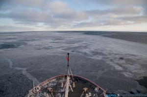
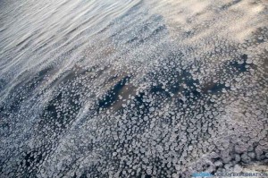
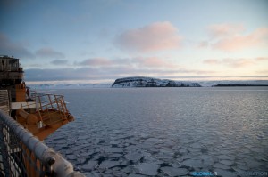
The day started out much the same way as the day before ended, with us steaming.  But within a few hours, we were beginning to see newly forming pancake ice!  There is nothing on this earth that is as beautiful as sea ice and if I needed reaffirmation of that, I got it today as we steamed through endless pancake ice to our next station inside M’Clure Strait.  As we approached Banks Island and the promontory that marked the opening to the Strait, the ice became a bit thicker and there was a quiet excitement to be sampling in this new and exciting area so far north.


Ice with Cape M’Clure in the distance

Pancake Ice

We continued around Cape M’Clure and into the Strait where we were going to sample, getting only 700 meters from shore for our first sampling station.  The sun was shining and it has to be one of the most beautiful places I have ever been.  With pancake ice forming before our eyes and yellow glowing cliffs, we watched the sun set over the cliff as we positioned the boat.  Truly a magical spot and to think about how few people have been here and the explorers that came here so long ago blew my mind.  Then it got dark and the moon was out and shining brightly, reflecting on the ice.  Only one word can describe this place: stunning.  Hard to put into words, but very special…as one person said, we are in a remote and special place…I couldn’t say it better…


Looking into the Strait: Cape Crozier

Out of the Strait: Cape M’Clure

Larger Pancake Ice as we headed to our sampling station

At our sampling station, only 700m from shore

The sun setting behind Banks Island

A beautiful Arctic night

October 16: Arctic Predator…POLAR BEAR!!!


©Gaelin Rosenwaks, 2011

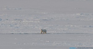
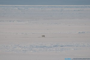
Whenever I come on expeditions, everyone wants to know what animals I have seen.  Here in the Arctic Fall as we find ourselves so far north, we have not seen many animals except for a few birds and the occasional seal.  Today while in M’Clure Strait, we saw the ultimate arctic predator, a POLAR BEAR!  As we steamed between stations towards Prince Patrick Island, there he was cruising all alone on the ice-covered sea; so beautiful and majestic.  In this super harsh environment, this bear survives in all its glory.  I feel very privileged to see a polar bear in its natural habitat, the sea ice.  The bear looked up at the ship and, not phased by us, went on walking…So incredibly beautiful!


Just cruising on the vast sea ice

October 16: Northernmost Point of Cruise


After a beautiful sun-filled day sampling in the ice that included a sighting of a polar bear, we reached the northernmost point of the cruise, just two nautical miles offshore of Prince Patrick Island on the north side of M’Clure Strait at 75.42 degrees North.  It is very cold up here with temperatures hovering around 3 degrees Fahrenheit, -13 degrees F with wind chill!  Despite the cold temperatures, I spent much of the day outside, going inside only when I could no longer feel my fingers enough to hit the shutter on my camera.  We finished our sampling line just as the sun set and the moon rose over Prince Patrick Island.  It was another stunning day in the Arctic!


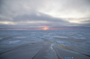
Sunrise in M’Clure Strait

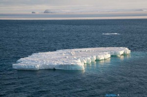
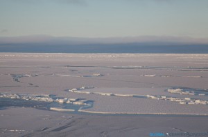
Sea Ice

Sampling in the Ice

Prince Patrick Island, the North Side of M’Clure Strait

After we finished sampling, it was time to head south through the ice to our next sampling area at the mouth of Amundsen Gulf.  The moon was shining brightly reflecting on the ice as we steamed south and said goodbye to a fantastic two days in the ice!


Steaming south out of the ice…

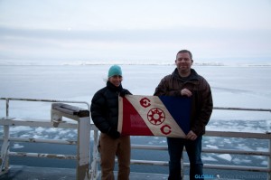
Explorers Club Flag


Gaelin Rosenwaks & Jeremy Mathis with EC Flag #118 in front of Prince Patrick Island, at 75.42 N

Both Fellows of the Explorers Club, Jeremy Mathis and I are honored to be carrying Explorers Club Flag #118 together on this expedition.  Flag #118 has been on many expeditions since its first expedition in Australia in 1946 including one to the summit of Mt Everest!  We are very excited to include our expedition in the great history of the Explorers Club and, as young explorers, to continue the great legacy of exploration that is embodied in the Club and the honor of carrying the Flag.


October 17: Steaming South, Amundsen Gulf


Map of the Cruise Track (courtesy Healy Map Server)

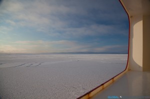
After an exciting two days in the ice, it was time to head south to our next sampling area at the mouth of Amundsen Gulf.  Half of our transit was in thick ice so the ship rattled and shook all night as we broke through the ice.  There is nothing quite like being on an ice breaker as it is very loud as we go through the ice and as we hit larger pieces of ice, the hull rattles and sounds as if it is going to break.  It is quite an experience and unlike anything else.  At around 3am, we hit open water and could then move faster towards our next stations about 240 nautical miles away.


Like the previous two days, we are sampling at the mouth of one of the straits of the Northwest Passage.  For centuries, explorers had looked for ways to navigate these waters to find a faster way to reach Asia for trade, although never successful in this mission due to ice blocking the passage.  Much like these explorers of the past, we are looking for modes of passage to the Atlantic but instead of searching for trade routes, we are looking for the pathways with which Pacific water is entering the North Atlantic.  During the summer, Pacific water takes a one-way journey to the Arctic Ocean through the Bering Strait and the question is: how does this Pacific water get to the Atlantic Ocean?  Does it find the long sought after pathway through the Northwest Passage or does it find another route?  We are hoping that sampling in these two straits will reveal the answer to this mystery or at least add some insight into this complex system of water movement.  One thing is certain, the global “conveyor belt” of ocean circulation is certainly more complex than we once thought.


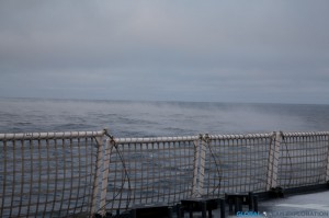
Sea Smoke rising off the water in the early morning near Amundsen Gulf

Another Arctic Predator…


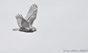
Bubo scandiacus (Photo Credit: Luke DeCicco, USFWS)

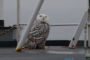
Polar bears are the quintessential Arctic predator, but there is another equally well-adapted creature to this cold icy environment, the Snowy Owl.  While we were sampling at the mouth of Amundsen Gulf, in the distance a large bird was flying towards the ship.  As the bird approached the ship, it became clear that it as a Snowy Owl soaring majestically around the ship.  Next thing we knew there was more than one and we had at least four owls flying around the ship!  It was incredible…a flock of Snowy Owls just coming by to check us out!


A snowy owl taking a rest on the ship

Profile: Stacey Reisdorph


The other half of the dynamic duo working with Dr. Mathis is Stacey Reisdorph, a master’s student at the Ocean Acidification Research Center (OARC).  From Iowa, Stacey has come a long way since her first time at sea on a Disney Cruise in 2009 as she immerses herself in the world of chemical and geological oceanography in the waters off of Alaska.

Starting off studying early childhood and elementary education at the University of Northern Iowa, Stacey soon learned that her passions lay elsewhere.  With the encouragement of her family and a fantastic geology professor, Stacey became a geology and earth sciences double major and had found her passion.  When it came time to apply to graduate school, Stacey fulfilled her dream of moving to Alaska when she was accepted into a master’s program in glaciology at University of Alaska-Fairbanks.  However, Stacey soon decided that she wanted to do something a little different and found a new home with Dr. Sam VanLaningham who suggested she start working with Dr. Mathis on a new and very exciting project in Glacier Bay.

After a little bit of bouncing, Stacey found a home in the Mathis Lab at OARC in January 2011 and is quickly becoming a chemical oceanographer as she delves into the water chemistry of Glacier Bay, a treasured National Park and home to many whales, sea lions, and otters.  Working closely with the Park Service, Stacey heads to Glacier Bay once a month to sample a series of stations for dissolved inorganic carbon, alkalinity, oxygen isotopes, nutrients, dissolved oxygen, total suspended sediments and particulate organic carbon.  Stacey is adding water sampling data to a time series of CTD data that has been collected since the early 1990s.

Glacier Bay is of particular interest because with climate change there is an increase in glacial meltwater entering the ecosystem leading to changes in the water chemistry.  Glacial meltwater is low in alkalinity and therefore decreases the ability of the water to buffer against acidification.  With this valuable time series of data, Stacey hopes to understand the dynamics and circulations patterns of the water from the mouth of the Bay to the freshwater sources throughout the year.


October 18 & 19: Mackenzie River Sampling


After completing our stations at the mouth of Amundsen Gulf, we transited to our next sampling area in the waters off of the Mackenzie River.  We are sampling here to determine the role of freshwater from the river on the acidity of the ocean.  The Mackenzie River is the largest river emptying into the Beaufort Sea; the only other being the Colville River which is one-tenth the size of the Mackenzie.  Therefore the freshwater input from the Mackenzie may play an important role in the ocean chemistry of the Beaufort Sea and Arctic Ocean.  The low alkalinity water from the river and high pCO2 (partial pressure) leads to decreased buffering capacity and higher acidity in the coastal waters.


While sampling near the river mouth, the water was clearly filled with silt from the river and the freshwater signal was high indicating that the river is playing an important role in the ocean chemistry of the area.


October 20: Aurora Borealis


With the sampling by the Mackenzie River finished, it is time for us to continue steaming to the west back towards Barrow Canyon to finish up some work there before heading back to Dutch Harbor.  It was foggy and snowy day with a long steam ahead of us.  In the evening, the skies cleared and the Northern Lights, Aurora borealis, illuminated the sky in a stunning display.


I have always dreamed about seeing the Aurora Borealis and knowing that we are so far north and in prime Aurora season, I have made it a nightly ritual to go out on deck to check for clear skies.  On a few evenings, the clouds have parted and the skies were illuminated with the shimmering green of the Aurora.  I am very excited to have seen the Aurora on a few occasions on this cruise although have found photographing the Aurora from a moving ship to be quite challenging.  I can now add the Aurora to the unique and extraordinary things I have seen on this expedition which have left me yearning for more time up here.


The Aurora with a silhouette of a buoy on deck.

October 21: “Apex of Avian Awesomeness”


Ross’s Gull (Photo: Luke DeCicco, USFWS)

As we reached our sampling site in Barrow Canyon, I received a message from the bird observer, Luke DeCicco, telling me to come up to the bridge immediately.  The last message I received from Luke to come to the bridge was to tell me about the Snowy Owls so I knew this was going to be good.  I was right as flying around the ship were flocks of Ross’s Gulls.  Ross’s Gulls are found only in the Arctic and very rarely go south of the Bering Strait.  The only way to see them in North America is at sea in the Arctic Ocean or off of Barrow in the fall.  They are tied closely to the ice edge and Luke had been anxiously looking for them the entire cruise.  He got his long awaited glimpse of what he called the “apex of avian awesomeness” with hundreds of Ross’s Gulls flying north by the ship all day.  He was in heaven and with one glimpse of these little gulls, I knew why.  Small in size, the birds have a very interesting coloration with a lavender grey back and wings and a pink breast.  The pink plumage, derived from their diet of krill and other plankton, is the same pink that glows in the sky at sunset and the grey is that of the Arctic sky.  A perfectly adapted little bird for their environment, I was excited to see these birds, another unique species to the Arctic!  Thanks Luke for the great photos!


(Photo Credit: Luke DeCicco, USFWS)

October 22: Rough Seas


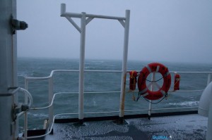
Rough seas are the story of the day.  I woke up with a start this morning at 4am with a huge roll that nearly threw me from my bunk.  It is blowing more than 30 knots and building with 10-12 foot seas and the Healy is rocking and rolling.  In conditions like these, scientific operations stop and we just have to wait out the weather.  I have to say that the ocean looks magnificent in power and fury, but walking to the lab this morning, I felt like I was nearly going to blow away.  Despite the storm, the Ross’s Gulls were still soaring among the waves along with a few other Arctic birds.  Not a great day to do science, but so awesome to witness seas like this firsthand!


October 23 & 24: Transiting to Dutch…


October 23rd was another rough day up here in the Arctic Ocean with high winds and big swells making operations difficult.  It also marked the end of the scientific mission as it was time to begin our transit back to Dutch Harbor.  The transit to Dutch will take about four days of steaming west through the Chukchi Sea, south through the Bering Strait and then south through the Bering Sea to Dutch Harbor.  We are hoping for some calmer seas, but it looks like storms are in the forecast.


Click Photo Above to Play Video of the Seas…

Sure enough on October 24th, I woke up to everything in my cabin sliding around and the momentary fear that I had not secured all of my cameras and equipment.  Knowing that the seas were going to build, I had put everything away but when those big rollers hit, flashes of flying cameras and computers went through my mind.  In the morning, we saw 50 Knot winds and 15-18 foot swells.  With all decks secured, I was forced to watch the power of Mother Nature from the bridge and aft control room.  It was intense with water sloshing over the fantail and up to the first deck of the boat.  Throughout the day, the seas and winds calmed a bit and hovered around 25 knots as we approached the Bering Strait in the evening.  We passed back south of the Arctic Circle and will enter the Bering Sea during the night.


Life on the Healy

We are supposed to get to Dutch Harbor tomorrow after a four-day steam through variable sea conditions, mostly very rough.  The Bering Sea is in her full glory with high winds and big seas, truly magnificent to see.  The USCGC Healy is a great ship and handles the seas very well.  I thought that this would be a good time to talk about this fantastic vessel and little things that make up the complete Healy experience.  While the science I have spoken about is at the forefront of the expedition, there is a lot going on behind the scenes on our floating home.   Here are a few highlights:
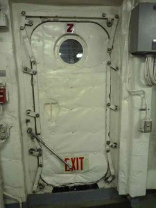
 

Because this is a big ship, there are a lot of doorways and hatches that must be closed and dogged every time you go through.  To walk from the lab to the galley via the inside passageway, there are five doors and they are my nemesis.  There is no need to work out while aboard the Healy because between opening and closing the doors and going up and down the steep stairways, or ladders, I get quite a workout!  It takes most of my weight to latch the heavy steel doors!  And to get to the bridge (05 Deck) from the lab deck (the 01 Deck), you have to walk up five flights of steep stairs (ladders) and through many doors.  These doorways of course make the ship safer as all the individual spaces are sealed from leaks, etc, but it is quite the workout to get from one space to the next!


The galley is a vital part of keeping the crew and scientist happy and well fed on the cruise.  The cooks do a great job of providing a variety of foods and always a vegetarian option!  Plus there are always lots of treats of cookies and cakes to fulfill everyone’s sweet tooth.


A few things help to keep me super happy while on board the Healy, one is certainly the coffee shop!  The Healy is the only vessel that I have been on that has a full coffee bar where you can get freshly brewed lattes or any coffee drink of your choice.  For a few moments, every day, you can get transported and have a latte served to you with a smile while sitting and watching surf movies care of Chris.

Morale nights play a big role aboard the Healy.  There are soccer tournaments, basketball games in the helicopter hangar, movie nights, and trivia to name some of the organized activities.  Along with a few other scientists, I have been playing trivia once a week and it has certainly helped pass some time!  And the crew has been awesome welcoming us to participate in their activities.
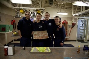
 

Celebrating a birthday aboard the Healy…Jesse Torres turns 21 and is greeted by some of his favorite treats, spam and fresh fruit, courtesy of Zach Young, Tyyler McNease and Evan Bergeson.

Big Seas in the Bering…


The Beautiful Bering Sea

We are in our final transit day to Dutch Harbor and we are witnessing the Bering Sea in all her glory with rough seas and strong winds.  It is magnificent to see the Bering Sea like this with waves going every which direction and a fierce wind blowing.  We are getting into Dutch tomorrow afternoon and enjoying every minute of this display of power.  Although being rocked about is a little tiring.


A wave behind the stern of the ship…we have a following sea…a VERY big one at that!

October 25-27: Transiting through the Bering Sea


After a four-day steam through big stormy seas, we are finally approaching Dutch Harbor and should arrive the afternoon of the 27th.  I am using this time to finish up some work and pack up all of my equipment.  All of the scientists are also packing and the lab is beginning to look barren as we are all getting ready to head home.

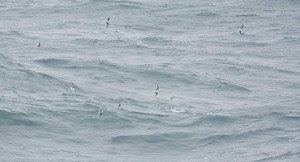
It is nice to be back in the Bering Sea with abundant birds flying by the ship.  In the Arctic Ocean, I was amazed by the dearth of bird life which only highlighted how extreme and harsh the conditions are so far north, but once we passed through the Bering Strait, the bird life became much more abundant.

Arriving in Dutch Harbor…The End of the Expedition


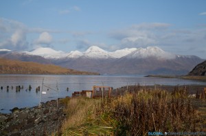
On October 27, the snow-dusted peaks of Dutch Harbor appeared in the distance and I knew that the expedition was coming to a close. Cruising through the Southern Bering Sea, there were many birds including fulmars, albatross and a variety of gulls soaring indicating that we were back in the prolific waters of the Bering Sea.  The abundance of fishing vessels on the radar indicated that we were in the midst of crab fishing season and that we were nearing “civilization.”  Until the 26th when we entered the crab fishing grounds, there were no other vessels in any proximity to the Healy for weeks.  As we pulled into Dutch Harbor, I was struck by the beauty of the Aleutians with mountains rising out of the water protecting this vital Alaskan port.  It is a truly beautiful place with eagles soaring and otters frolicking.  The sun came out illuminating the mountains.  After passing Priest Rock, we turned and could see the low buildings of Dutch Harbor and Unalaska.  Upon completing a successful mission, we returned to port and felt dry land for the first time in four weeks.

The view from the airport parking lot before flying home…Goodbye Dutch Harbor…

.

For more information and to view photos, go to: www.globaloceanexploration.com